Greensted Church (or, Walls Can Talk)

In a land of grand cathedrals, the Church of St Andrew, in the village of Greensted-juxta-Ongar in Essex, UK, is a modest church – smaller than some country chapels I’ve seen in back country Georgia.  Greensted Church has that eclectic mix of architectural styles common to buildings that have seen centuries of fashions come and go.  Some of the brickwork is Victorian, while the clapboard tower rose in the early 1600s. Bricklayers constructed the chancel in the 16th century.

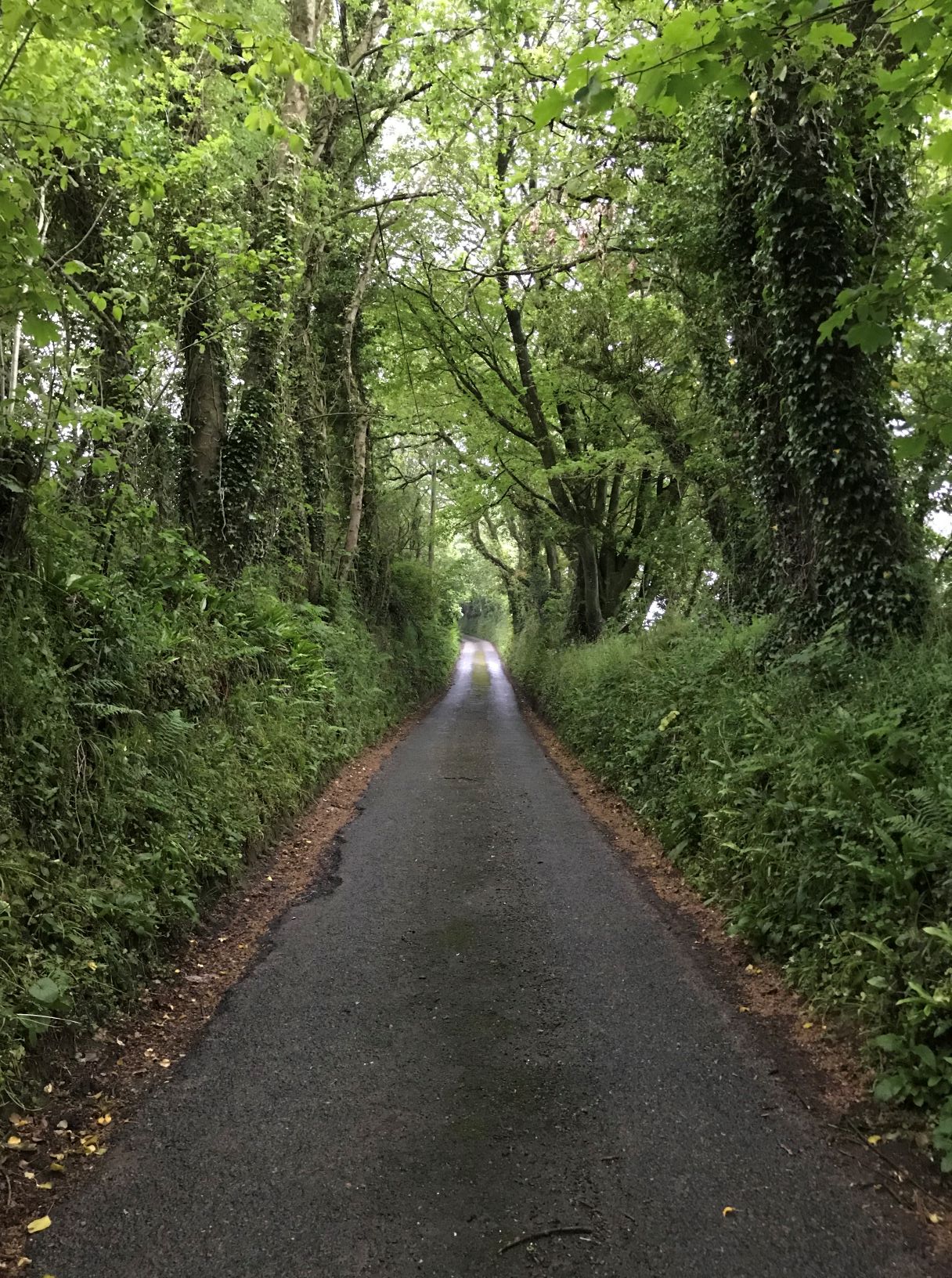
But none of those antiquarian details drew me down narrow country lanes in the remnants of Epping Forest; it was the nave that brought me here. Originally constructed of split tree trunks, each standing on end, Greensted Church is classified as a palisade church — an early version of a construction technique which evolved into the stave churches still found in Scandinavia.  Sections of these ancient walls remain in Greensted. These logs can be aged based on dendrochronology. 

Old oak log

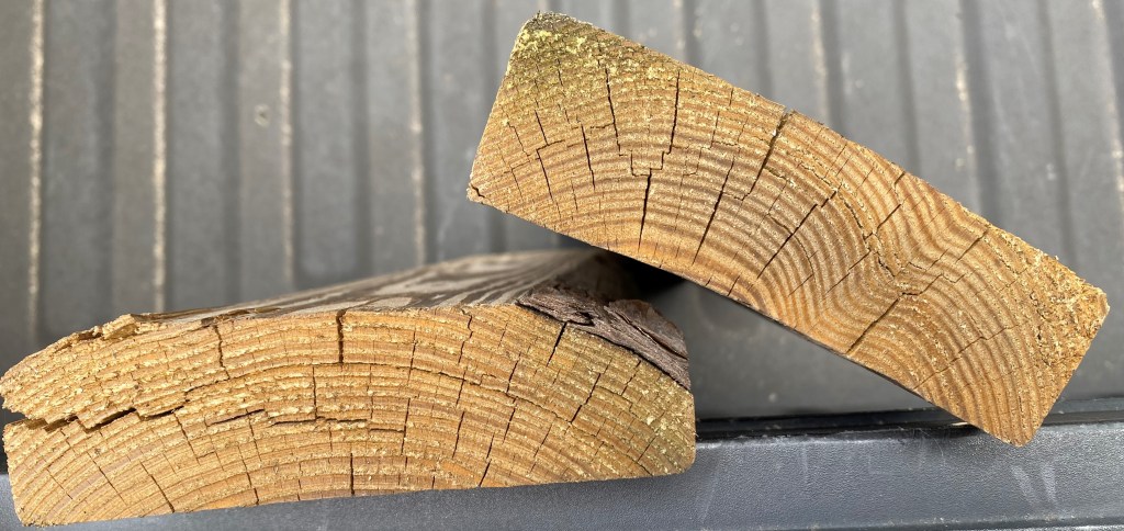
Dendrochronology? Yes, scientists love their Greek and Latin, and in Greek this technical term means “Study of Tree-Time”.  Dendrochronology is a way to determine when a log was a living tree, and this works pretty well in temperate zones with distinct growing seasons.  Trees grow new wood just beneath the bark, so the trunk gradually expands in diameter.  This growth is more rapid early in the growing season, resulting in larger cells. Later in the summer, growth slows and the new wood is denser.  Thus, each year’s growth consists of two rings – one pale, one darker.  You can count the years of a tree by ticking off the number of dark rings counted on a tree stump. Oak is especially consistent in laying on rings, but other species can be used for dating.

In years where there is favorable moisture and temperatures, trees will put on more wood and the rings will be wider.  In dry or cold years, the rings will be narrower.  And these climatic variations affect all the trees in a region.  Did a given county have a wet year in 1523, followed by several drought years?  The wood will show a wide ring, followed by several narrow ones.  In some cases, such as when a volcanic event causes planet-wide cooling, forests on several continents mark the event. 

How can this be used to determine dates?  Humans have built things out of wood for millennia.  When you have enough samples, you begin to see overlapping patterns.  Imagine a wood panel from a manor house.  It was harvested from a 180-year-old oak that was twenty years old when, say, a decade of good weather allowed it to put on wide rings.  Elsewhere in the county is a bridge plank that came from a tree already growing for a hundred years when that same weather phenomenon occurred, and then was cut almost immediately.  Noting where those ten unusually-wide rings occur on the boards will give you a good idea of when the trees were growing, and when they were cut.  In this example, if you have records showing the mansion’s paneling was installed in 1750, you can use that information to estimate when the bridge plank was cut a little after 1590. 

This is a simplified example and leaves out some of the obstacles to precise dating. You only know for certain how old the tree was when cut by looking at a complete section of heartwood and sapwood from near the base of the tree (which includes the very oldest wood).  Most sawn boards do not include the whole radius of the log, so you don’t know that the last ring you see is the last one the tree put on. Further, one can’t always be sure the wood hasn’t been reused from some other structure – the mantlepiece in my new house was originally part of a barn built in the 1850s. Still, having some of the wood is useful, and by overlapping the recognizable patterns on existing wood samples, scientists can date structures going back hundreds or thousands of years.

Rings in old pine boards. The final tree ring is beneath bark on the lower board

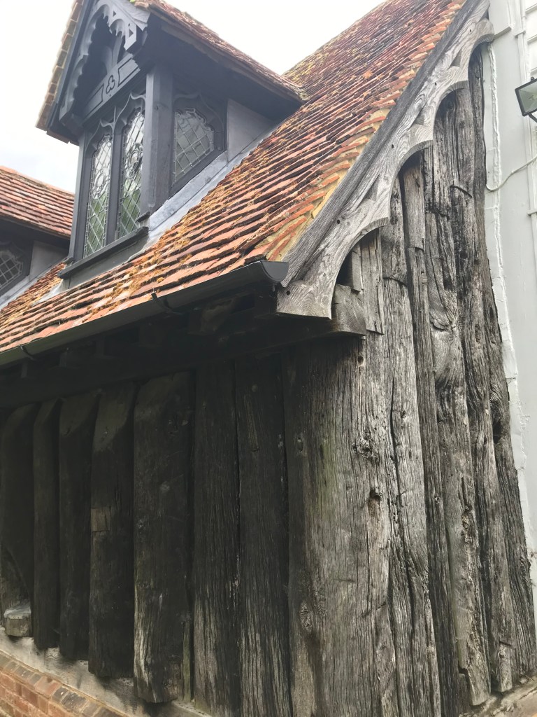
 Dendrochronological analysis of the old wood on the Greensted Church suggests a minimum date of 1053, with an allowance of 10-to-55 years added for sapwood that has worn away in the intervening centuries.  It may well be that the nave stood before the Norman Conquest; at any rate, the church is a contender for the title of oldest wooden church in the world, and the oldest wooden building in Europe.

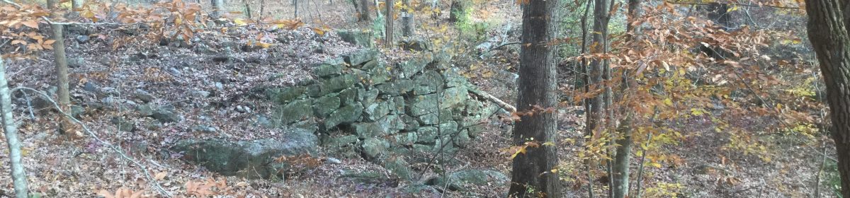
Evidence points to a much older building, as is often the case on holy sites; excavations in the 1960s revealed timber structures dating to the 6th and 7th centuries — in the years when the East Saxons were newly-converted.

In a trip that saw structures both grander and far older, why spend time in an out-of-the-way little church? Because I have a historical interest in the Anglo Saxon period of Britain; I wanted to rest my hands on this timber that was likely felled and worked by Saxon craftsmen.  It was coup-counting, pure and simple.  But what historical enthusiast would not do the same, given the chance?

Additional Resources:

Dendrochronology from Historic Britain (a pdf)

All Roadways Great and Small

Here are a few thoughts about driving in England, from an American perspective.

This is besides the left-side driving (I’d repeat the mantra “Driver in the middle, driver in the middle”) or roundabouts (simple once you know some rules such as “the one in the roundabout has the right-of-way”).

The thing to be cognizant of is that most roads were set in place before the invention of the automobile. 

Don’t get me wrong; after a couple of days practicing in Suffolk, I was relatively comfortable behind the wheel, so long as I skirted the towns. By the time we’d made our way across the country to Cornwall, I was playing the theme to All Creatures Great and Small on my phone and in my head while driving through this green, pastoral countryside.

The largest roads, the motorways (Designated with M- just like our interstates are I-) are typically divided highways, with 2 lands each.  Unlike interstates, shoulders are not a given.  There may be periodic pull-offs, but much of the roadside is tall weeds or rocks.

The next roads (often with the A- prefix) are like our 2-lane roads, again excepting the lack of shoulders.  Hedgerows, banks, and walls are common, and pull-offs are infrequent.  The listed speeds are 50 or 60 unless near towns, but I rarely felt comfortable going that fast.  The roads seldom have long straight and level stretches, so passing isn’t something I practiced a lot. 

But wait, it gets more interesting.  Farther in the countryside (and some village streets) are what I called 1 ½-lane roads.  Same obstacles on the sides, but meeting an oncoming car leaves no room for error.  The two vehicles creep past each other, left mirror brushing weeds, right mirrors not quite touching.  In villages, parking takes up most of a lane, so opposing drivers have to decide who yields.

Then there are the tracks that, while paved, are meant for 2 horses abreast or one modern car.  If you see headlights, either find a pullout (which may be just deep enough for your passenger wheels) or back up.

One things to remember on anything less than an M road: travel will invariably take longer than you expect. In my home county, I can cross 17 miles of rural road in around 20 minutes. Along the winding tracks of rural England, a 3 mile drive took over 10 minutes; another 5 mile distance, 20! Folks used to rapid mobility will need to recalculate their travel estimations.

I negotiated the roads without major incident, owing in part to the fact that the drivers around me tended to be more polite, and forgiving, than I had a right to expect.

Footpaths

Moor path

Public Footpaths: one of many discoveries my family made on our trip to the UK.  Sounds simple, right?  A simple green sign points the way to a walking trail through a pasture, along a hedgerow, or down by a stream.  The rural areas we visited were fairly threaded through with footpaths.  But I have to say, using these trails made me feel a little transgressive, like I was getting away with something.  Of course, the US has trails for the public as well.  But they are usually on publicly- owned lands, whether a national monument, state natural area, or city park.  You don’t cross into private land uninvited without risking a call to the police or a bullet zinging overhead.  But in England, if it’s marked, you can walk, take photos, even have a picnic in a stranger’s pasture.  In America, walking through someone’s property – field, woods, even transmission line – without permission is trespassing; in England, if there is a marked public footpath, it is illegal to block it!  And by one source, there are something like 140,000 miles of public footpaths in England and Wales (Scotland has a similar concept, but the rules are different).

I visited a handful of footpaths during our visit to the south of England.  The first one was near the village of Wellow in Somerset, as we quested for a Neolithic barrow said to be in the area.  Crossing a wooden stepladder that bridged a fence, we found ourselves among sheep who were apparently used to ramblers.  I felt a bit wary because, as I said, I half expected to be yelled at by an irate farmer.  But we were not accosted as we followed a faint fence line path up a hill, then across the hill alongside a hawthorn hedge, until reaching our goal (which no doubt I will discuss in a later post).  As we left, we passed two or three folks who drove here to walk their dogs. This trail I thought was back-of-beyond was getting a fair bit of use this afternoon.

Alley path

The next excursion began in the village of St. Tudy in Cornwall.  A footpath sign pointed down the alley between our cottage and the next, so we followed.  The first bit of trail was fenced on either side, railroading us straight through two yards to the pasture, where a sign on the gate warned “Beware of Bull”.  The path wasn’t so well-worn, so we had to follow along walls and hedges to see what was a proper crossing and what was merely damage from the escape attempts of livestock. 

beware bull
Fae path

Eventually, we gave up on the path and wove through pastures until we reached a paved road.  Returning to the village, we were almost in sight of home when the daughter saw another Public Footpath sign, which drew her like faery song down a narrow dark track, close-mantled by hedge and tree.  Again, we steered by steps in the walls rather than a visible path, until drizzle and fading light coaxed us into turning heads for home.

I loved the concept of the public footpaths.  It is a concept embedded in British custom and is likely too alien to gain traction in our land where property rights are so jealously guarded.


Additional Information:

Walks Around Britain

Finding paths